Monthly Archives: August 2009

Streetcar Planning in DC

One of Torontos Red Rockets

One of Toronto's Red Rockets

While I was out on vacation, wheels started turning on getting DC’s streetcar planning back on track (har har).  Public meetings, platitudes, and so on.  BDC offers the quick and dirty summary:

I wasn’t able to attend last night’s streetcar meeting with Gabe Klein, but based on summaries I’m not sure we learned all that much that we didn’t already know. The key points seem to be that Klein wants streetcars to be a priority and is appointing a new streetcar czar, that the Federal government is more excited about streetcars than in the past, that we’re still not sure about the overhead wire issue (but someone in Congress may address it soon), and that we’re still looking at 2012 before the first line in Anacostia opens.

However, there are still some serious questions about rather basic items (even leaving aside the power issue for now), like route alignments.  Greater Greater Washington notes:

Klein reiterated support for the streetcar alignments in the current Comprehensive Plan. The first streetcars will run from Anacostia over the 11th Street Bridge, and along H Street and Benning Road, ultimately connecting to downtown on the K Street Transitway. Phase two is 7th Street and Georgia Avenue, and Minnesota Avenue between Anacostia and the Minnesota Avenue Metro near Benning Road, connecting the two lines across River East. There are still many outstanding alignment questions, like how to connect the streetcar to Union Station, where to continue it over the 11th Street Bridge (to Eastern Market? M Street SE?), and where to place maintenance facilities and storage yards for the H/Benning line.

The Comprehensive Plan highlights these routes, complete with rather nebulous distinctions between modes – Streetcars in blue, BRT in green, and “rapid bus” in Yellow:

The first obvious question is to determine what other transportation facilities might be implemented in the near future.  I’m thinking specifically about Metro here.  I bring it up because the core of the streetcar alignments in Downtown look an awful lot like the ideas for separating Metro’s interlined portions of track.  From my earlier fantasy posts, potential new Metro trackage (comprised of a New Blue line and New Yellow line through downtown) would look a lot like the core ‘cross’ of the streetcar lines in the DC Plan:

After plenty of lengthy debates about the utility of streetcars asa means to improve mobility, it’s worth considering the chances for Metro (an unquestioned improvement in both mobility and accessibility) to come to those corridors, and potential time frames for such investments.   Streetcars and Metro can and would complement each other well along the same corridor, just as high frequency bus routes complement Metro (think the 30s bus lines and the Orange/Blue trunk line through the city, for example), but I have a hard time believing money would be available for both.

As the DC Plan indicates (and the other streetcar plans floating around reinforce), there are lots of places where streetcars could be effective in DC.  However, there are few remaining corridors suitable to heavy rail transit.  When combining that with the long term needs to eliminate interlined portions of track, this becomes a question of long term planning and vision.

Part of the value of these fantasy transit maps is the visioning they bring to the table.  My worry with the streetcar planning is that things are too compartmentalized to plan for a holistic transportation system, both within DC and the region as a whole.  Metro is set to see tremendous ridership growth over the next 20 years, and ensuring the transit system as a whole can handle the demand will be a tall task.  Streetcars will be an improvement, but core expansion of Metro shouldn’t be off the table, either.

(DC Streetcar Plan)

More warehousing

Building off the previous posts on warehouses and their districts, I have some more pictures from my most recent (and a few older ones as well) trip to Minneapolis, focusing on the Warehouse District.

IMG_4477

Two main streets define the Warehouse District – Washington Avenue and 1st Avenue.  These streets run perpendicular to each other.  Washington runs (kinda) East-West (Minneapolis’ street grid downtown is skewed off axis, orienting towards the Mississippi River) and 1st runs North-South.

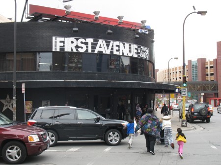
First Avenue is closer to the core of downtown, and the warehouses there are more ornate and quicker to redevelop.  At the southern end of 1st Ave is Minneapolis’ arena, the Target Center, as well as the legendary music venue, First Avenue:

IMG_4463

You can almost hear Prince doing a soundcheck inside.

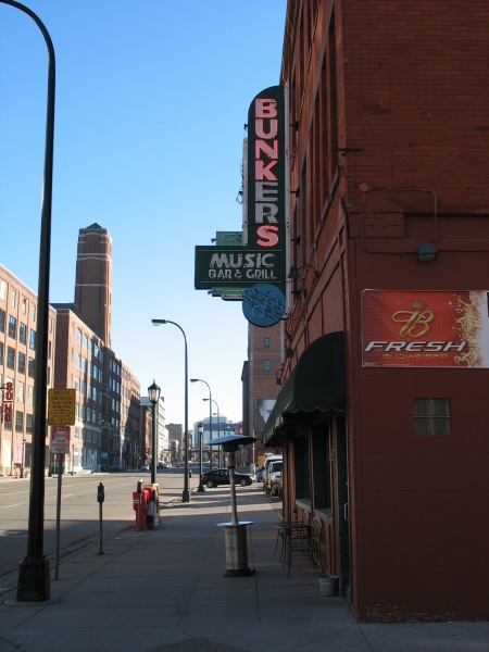
Washington Avenue is revitalizing as the new North Loop neighborhood, but it’s still a raw place:

IMG_1184

There’s been plenty of new investment in the area, both in renovations and new construction:

IMG_1205

IMG_1203

New developments are adding retail to the area, complementing some older establishments:

IMG_1181

IMG_1186

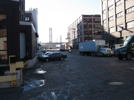
And all this time, industry rolls on in the area:

IMG_1200

IMG_1202

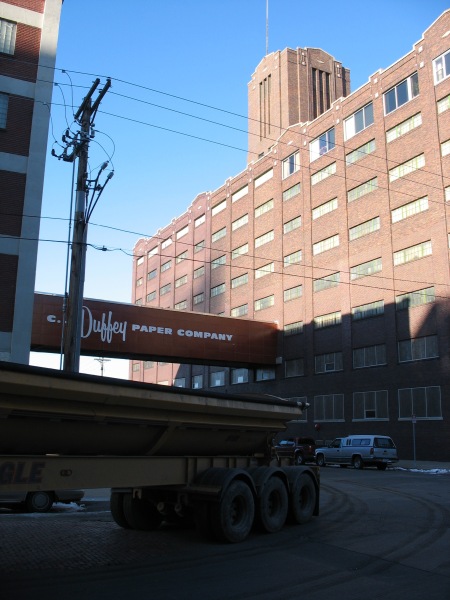
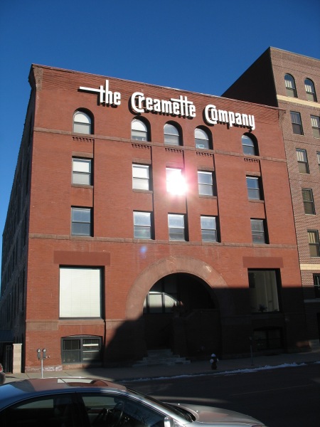
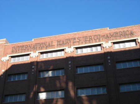
And there are plenty of vestiges from past industries – Creamette, International Harvester,

IMG_1170

IMG_1196

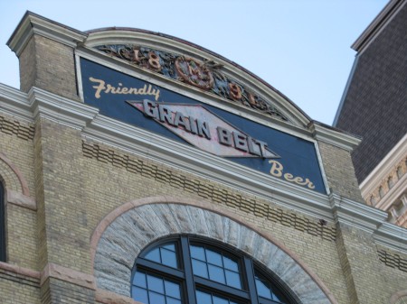
And a little outside of the Warehouse District proper – the old Grain Belt Brewery:

IMG_1235

Minneapolis – Nicollet Mall

Some more photos from my trip to Minneapolis.  My light rail ride into downtown ended at the Nicollet Mall station.  Once arriving in downtown, the Light Rail line runs through the city on 5th St.  Because of the dedicated right of way (even though there is substantial cross traffic), 5th street is more or less a de-facto transit mall.  However, Minneapolis has a more prominent transit/pedestrian mall – the Nicollet Mall.

Nicollet Mall encompasses the bulk of Nicollet Avenue as it runs through downtown.  The Mall was created in 1968, like many of its counterparts, as a response to downtowns losing retail market share to suburban shopping malls.  At that time, Minneapolis bulldozed their most prominent retail street and re-built it as a pedestrian and transit mall.  It was one of the first, and remains one of the most ‘successful’ malls – along with the 16th Street Mall in Denver, State Street in Madison, and a handful of others.  There have been far more failures than successes here, I’m afraid.

Nevertheless, the Mall worked here.  At least, it didn’t completely fail.  Downtown continued to lose retail in the grand scheme, and Minneapolis’ skyway network proved to be a Faustian bargain – keeping many offices downtown by offering the same kind of climate control you’d find in suburban office buildings with nice connections to their parking garages, but at the expense of any sort of street level retail or streetscapes.  For better or for worse, the skyways are part of Minneapolis’ heritage.

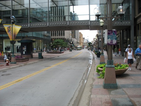
Perhaps that kind of heritage stacks the deck for something like the Nicollet Mall to succeed.  It’s the one street in downtown where the sidewalks are generous, as is street-level retail frontage.  Arriving from the Hiawatha Line, you enter the Mall on the northern end, at the intersection of 5th and Nicollet:
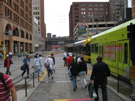
IMG_4440

As the light rail trains continue down 5th street, most pedestrians hang a left onto Nicollet.  Once there, they’re greeted with the one downtown street with nice trees and wide sidewalks:
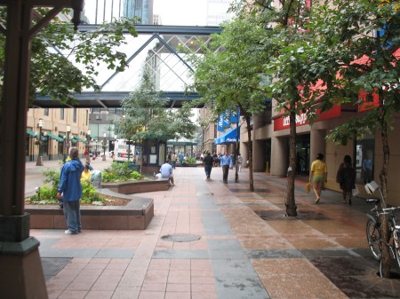
IMG_4449

The fact that no other streets downtown have good street trees is a bit puzzling, since Minneapolis as a whole has some of the best urban forests and tree canopies of any American city.  But not downtown.

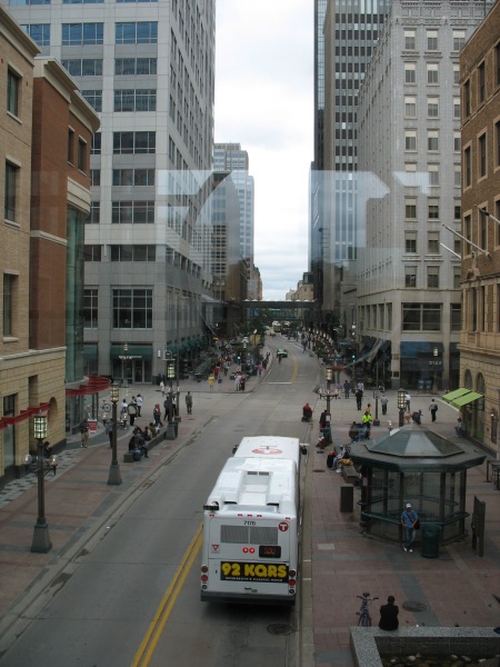
The transitway itself does not shoot straight down the center of the right of way.  Instead, it weaves back and forth, like a wave.
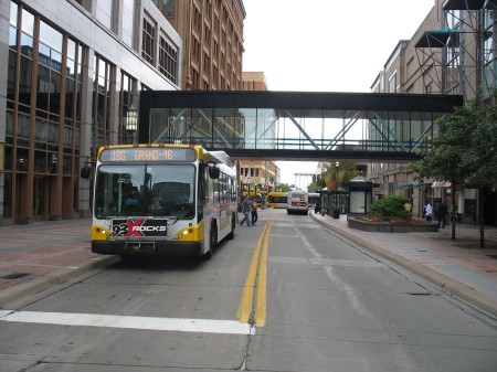
IMG_4447

IMG_4452

IMG_4458

The weaving is an homage to Minneapolis’ aquatic history and connections.  The City of Lakes takes water seriously – as it provides some of the greatest amenities today, yet was also the sole economic reason for the city existing at all.  Functionally, however, the weaving of the traffic lanes allows for a minimum sidewalk width along both sides of the street, while also providing adequate space on the wider portions for street art, bus shelters, fountains, benches, etc.

Nicollet Mall also hosts a weekend farmer’s market, numerous civic parades and festivities, and all sorts of other hullaballoo.  These events usually happen on evenings and weekends, however – where buses are re-routed to adjacent side streets.

A great deal of Minneapolis’ north-south bus routes through downtown utilize the Mall. From the photos, you’ll notice that those buses are the only vehicles using it.  Taxicabs are allowed after the evening rush, and bicycles are similarly restricted from riding on the Mall, much to the dismay of sign vandals:

IMG_4453

The lack of regular facilities for cyclists brings to mind the debates over the configuration of the K Street transitway, and the role bike lanes should have in it.  It raises the question if it’s possible or desirable to have all streets downtown serve all modes, or if prioritizing one mode on a few streets over others is sufficient.

Minneapolis’ problem is that all of the other streets in downtown have cars as the top priority.  Though bike lanes have been added in recent years, the overall pattern is unmistakable:
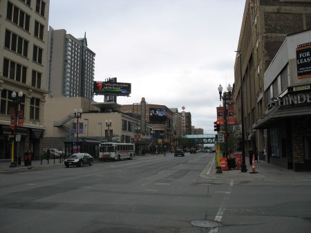
IMG_4460

Hennepin Avenue, above, has the potential to be a great urban street – but storefronts are spotty, sidewalks narrow in relation to the traffic lanes, and the urban fabric is a bit disconnected in spots by surface parking lots.  There are many great old theaters in the area that would be a tremendous asset to the city, but the streetscape isn’t quite there yet.

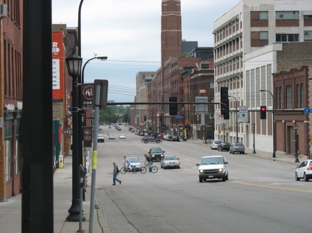
Other streets, particularly many cross-streets running east-west, are even worse:
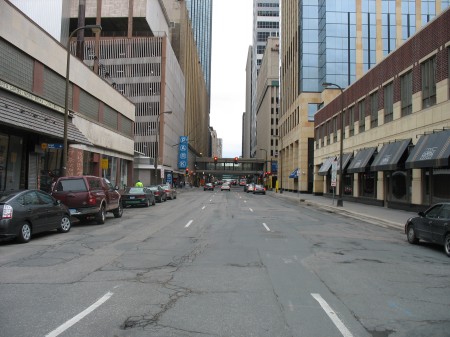
IMG_4461

Almost all of them are one-way pairs.  I don’t have any information on Minneapolis’ downtown traffic, but I don’t ever recall the area’s small and compact grid being unable to handle traffic – removing one of those lanes and widening sidewalks a bit, adding trees, bike lanes, and the like would be a tremendous improvement.  Street frontage along those sidewalks would instantly become more inviting.

In some respects, however, the issues of streetlife and vibrabcy are a chicken and the egg problem.  Sure, there are design issues – but you need a base of customers and residents to support those retail spaces.  Nicollet Mall does an excellent job of concetrating that retail energy in one place that can achieve critical mass, but even that shows the weaknesses of Minneapolis’ current downtown demographics:
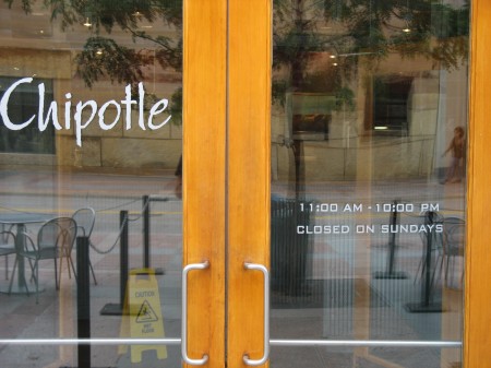
IMG_4454

Closed on Sundays?  A big chain like Chipotle is the kind of place you’d expect to lead the charge to be open on Sundays.  I’ve seen longer lines during the weekends at the Gallery Place Chipotle than I see during the normal lunch rush.

This particular Chipotle is located in the base on the Target world headquarters building, fronting on Nicollet Mall.  The retail spaces along the Mall are all occupied, and Target’s two-block complex includes this Chipotle, the Dakota jazz club, the News Room bar, a 2-story urban Target, and other retail as well.

That urban Target Store (at the base of Target’s world headquarters) did not come easily.  This may seem like a common tale to anyone who’s followed the DC USA development:

There have been plenty of criticisms during this election year. The three top challengers in the Minneapolis mayoral primary railed against Sayles Belton’s support of the project, portraying it as a gift to Target and developer Ryan Construction at the expense of small business and affordable housing. Remaining challenger R.T. Rybak continues to hold it up as the quintessential example of so-called corporate welfare.

At the same time, there are different versions of how much the city paid. The Minneapolis Community Development Agency, the office that shepherded the deal, puts the public cost close to $60 million. MCDA project coordinator Phil Handy says $35.5 million of that goes for what’s called site assembly – buying the land, paying legal and regulatory costs, and cleaning up any lingering pollution – things that would need to be done no matter who developed it. Handy says much of the rest, nearly $18 million, paid for construction of the underground parking ramp that the city now owns and operates. Handy says this money shouldn’t be viewed as a subsidy.

It’s worth noting that R.T. Rybak is now the Mayor of Minneapolis, though this was hardly the sole reason for his election.

One other requirement the city put out for Target’s development of the area, however, was that each of their buildings would have retail spaces fronting the street on all sides.  However, except for the Nicollet Mall facade, those storefronts remain empty and have never been filled.  Target, as a landlord, isn’t actively seeking tenants.

Minneapolis has made great strides as a city since I grew up there, but it’s still got a ways to go before becoming a full time big-city downtown.

More Updates

Spirit of Detroit

Spirit of Detroit

Still lots of good stuff to comment on since I was out of town…

What’s goin’ on in the D? Aaron Renn has a great post on the current state of Detroit.  If you haven’t been out in the neighborhoods, it’s hard to emphasize how open and desolate it is.  During my time in graduate school at the University of Michigan, I had multiple opportunities to spend time in Detroit.  Mr. Renn gives a fair assessment of the major problems facing the city, but also the unusual opportunities stemming from those problems.

In most cities, municipal government can’t stop drug dealing and violence, but it can keep people with creative ideas out. Not in Detroit. In Detroit, if you want to do something, you just go do it. Maybe someone will eventually get around to shutting you down, or maybe not. It’s a sort of anarchy in a good way as well as a bad one. Perhaps that overstates the case. You can’t do anything, but it is certainly easier to make things happen there than in most places because of the hand of government weighs less heavily.

What’s more, the fact that government is so weak has provoked some amazing reactions from the people who live there. In Chicago, every day there is some protest at City Hall by a group from some area of the city demanding something. Not in Detroit. The people in Detroit know that they are on their own and if they want something done they have to do it themselves. Nobody from the city is coming to help them. And they’ve found some very creative ways to deal with the challenges the result.

As the focus on agriculture and even hunting show, in Detroit people are almost literally hearkening back to the formative days of the Midwest frontier, when pioneer settlers faced horrible conditions, tough odds, and often severe deprivation, but nevertheless built the foundation of the Midwest we know, and the culture that powered the industrial age. No doubt in the 19th century many of those sitting secure in their eastern citadels thought these homesteaders, hustlers, and fortune seekers crazy for leaving the comforts of civilization to head to places like Iowa and Chicago. But some saw the possibilities of what could be and heeded the call to “Go West, young man.” We’ve come full circle.

Nature abhors a vacuum.  Even with Michigan’s crappy economy, prices in Detroit are so low that there’s opportunity for small scale revitalization.  Nothing large-scale is going to happen without larger changes in the economy, but some of the anecdotal stories are amazing.

If anyone needed convincing of the capacity of mass transit, consider this thought experiment about what Manhattan would look like without a subway:

Just to get warmed up, chew on this — from 8:00AM to 8:59 AM on an average Fall day in 2007 the NYC Subway carried 388,802 passengers into the CBD on 370 trains over 22 tracks. In other words, a train carrying 1,050 people crossed into the CBD every 6 seconds. Breathtaking if you ask me.

Over this same period, the average number of passengers in a vehicle crossing any of the East River crossings was 1.20. This means that, lacking the subway, we would need to move 324,000 additional vehicles into the CBD (never mind where they would all park).

Of course, at 325 square feet per parking space, all these cars would need over 3.8 square miles of space to park, about 3 times the size of Central Park. At that point, who would want to go to Manhattan anyway?

Cap’n Transit doesn’t want to take your car away. Just in case this popular line of anti-transit rhetoric comes up again, the Cap’n makes it crystal clear:

No, I don’t want to take your car away. I just want there to be some reasonable transit around for me to take when I’m old, and for my kid to use. I don’t want you to kill the hope of a sustainable rail transit system because you spent all my tax money on your stupid highway widening and airport runways. Can you please think about sustainability before it’s too late and we’ve wasted everything we’ve got?

Miscellany:

  • Twin City Streets for People has a nice post on the Three D’s – Density, Diversity, and Design.  The author makes the case for focusing on design as the primary component of TODs rather than density – not because density isn’t important, but because it can be a lightning rod for opposition.  Emphasizing design allows to deflate concerns that conflate density with height, crime, and all the other usual fallacies.
  • Dr. Gridlock notes that people are losing trust in Metro.
  • Matt Yglesias draws attention to US demographic changes and how they favor urban living – also noting the potential for such gains to start positive feedback loops within urban communities and economies:

In particular, even if you assume no shift in underlying preferences regarding cities versus suburbs, and no pro-urbanism policy shifts, then the declining proportion of the population made up of families with children still implies a large shift back in the direction of urban infill.

Judged realistically, this should also open up possibilities for virtuous circles. Some people prefer to be surrounded by a lot of space, and others prefer the amenities associated with a denser urban environment, but nobody likes to live in a block with a vacant lot or around the corner from a broken-down shell of a former building. More people shifting into walkable urban neighborhoods allows those neighborhoods to capture more of what’s appealing about walkable urbanism.

Warehouse follow-up

GPO. Image from takomabibelot on Flickr.

GPO. Image from takomabibelot on Flickr.

Noah Kazis responds to my critique of his GPO-block analysis.

All in all, I don’t think we’re that far apart in our opinions – something I think Noah highlights quite well.  A few points:

First, Kazis notes that the old warehouses from Minneapolis I cited as exemplary all feature street-level retail:

It’s still a pleasure to look at buildings like the ones Block points to in Minneapolis (although I would point out that unlike in D.C., those have ground-floor retail, making them “hulk over the street” less).

This is absolutely true, but I’d also point out that none of them were designed with street retail in mind.  The first floor is not usually at the same grade as the sidewalk, it’s raised up by a handful of steps.  Many of the bars along 1st Avenue are ‘basement’ bars.  The point, however, is that despite ideal conditions, those types of buildings can be successfully re-used.

Regarding government ownership of the site, I was surprised to see that DC owned all the land in those parking lots.  I had assumed that the Feds owned it.  However, my point was simply that divestment of government land takes more time than transactions between private parties.  I’m not sure the choice of DC USA is a good example, as that development was a long time in the making.

Kazis also makes some excellent points about scale, and the different interpretations you can have from different frames of reference. Indeed, I think our differing conclusions about the block in question can be chalked up to different scales.  There’s no doubt at the pedestrian’s scale, the experience around the GPO is dull at best.  At a wider scale of 3-5 blocks (or, what might be a reasonable walking radius from a transit station), the development patterns in the area are far more legible and easily attributed to broader issues in the area.

I’m also relieved to know that Kazis’ reference to bulldozing our history was not a literal one:

I quite agree that the GPO building will remain. When I wrote that we need to figure out how not to “bulldoze the past,” I wasn’t talking about specific buildings. At the end of the day, architecture matters much less to me than use. The core GPO building will survive, in somewhat altered form, but it won’t be industrial anymore. The Gales School, I imagine, won’t last at all, much less as a homeless shelter. The block, like many blocks before it, will be subsumed into D.C.’s extremely monotonous (though with many great individual buildings) downtown.
This gets at a much bigger discussion.  Here in DC, numerous folks have termed it ‘office sprawl.’   This dispersion of the traditional CBD functions over a wider area is both a blessing and a curse of DC’s height limit.  It’s worth noting that Minneapolis’ downtown has tons of surface parking lots in key locations.  It’s also worth noting that the warehouse district there has evolved a great deal over time.  As a kid growing up there, most of it was still semi-industrial space – available cheap, used by artists and as start-up space.  Now, many of those buildings have been renovated as luxury lofts or office space.  Uses have evolved a great deal over the past 20 years, as has the level of investment.  That’s a constant of urban life and adaptive re-use.  Acknowledging the shortcomings of such changes and mitigating those effects is the best we can do.

Again, I don’t think we’re that far apart.  It’s always a good discussion to have.

Minneapolis – LRT Stations

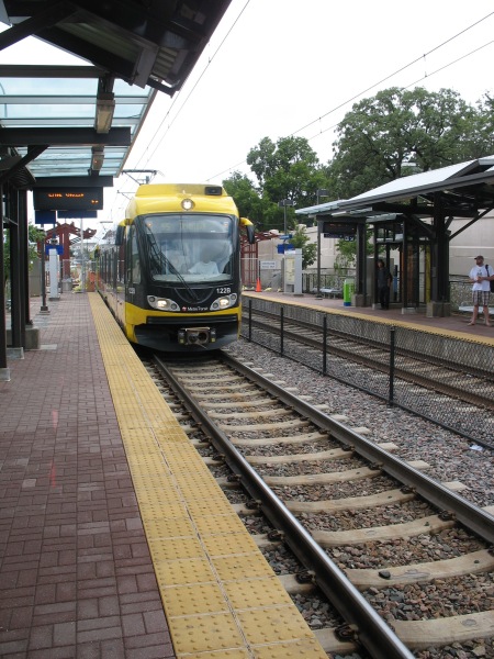
Following up on the post from the Mini-apple on LRT vehicles, I’d like to show some of the more interesting details from the LRT stations that dot the line.  It’s an interesting contrast to DC and Metro.

Metro was designed as a coherent system – from the way the routes interact with one another to the way the signage meshes with the station architecture.  Initial concepts were for all stations to be exactly the same, and though this was soon abandoned in the face of realistic problems, all of the stations in the system nevertheless share several key design principles and materials.  The common elements are so strong that minor deviations from those principles stick out like sore thumbs.

In Minneapolis, such a rigid, systemic design approach wasn’t used.  Each station has not only a rather unique design, they all have their own personality that explicitly aims to reflect the neighborhood they serve rather than the uniformity of the system.  Such is the difference between Federal orthodoxy and Minnesota Nice, I guess. There are a few ‘boilerplate’ stations where the structures are the same, but each station still has distinct color schemes and other small details.

Moreover, each station has a plethora of intricacies for riders to discover.

IMG_4435

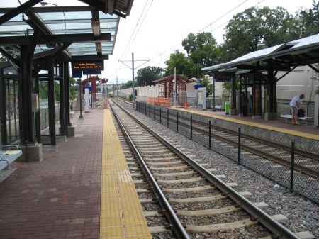
All stations have several common elements – some sort of partial canopy cover, benches, wind screens, ticket machines, etc.  The details of those elements is where the variations can be found.

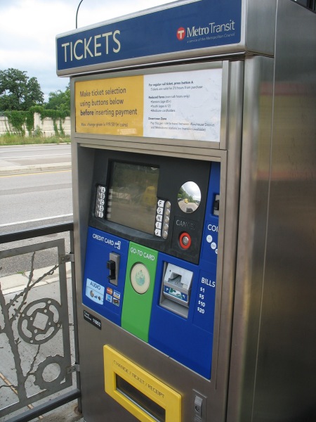
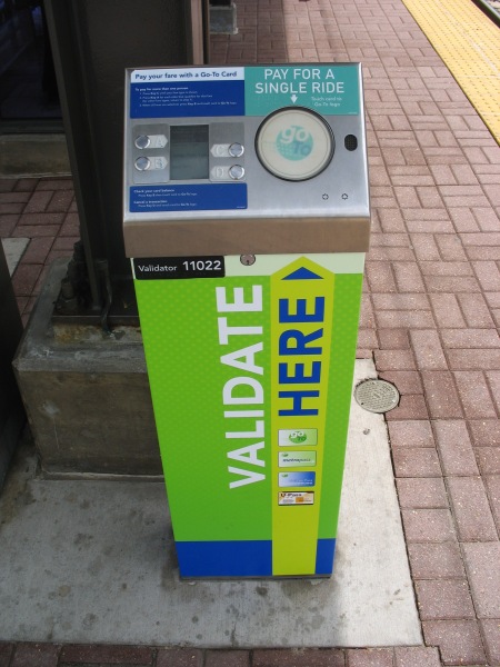
The ticket machines are relatively easy to use – nice and straightforward, accepting of cash and credit.  Your fare is good for 2.5 hours.  It’s a proof of payment system, so you have to grab a ticket before hopping on.

IMG_4434

The green circle in the center is an RFID card reader for using a Go To card (Metro Transit’s version of SmarTrip) to purchase a card.  They also have separate machines that cater only to Go To card holders.  Tapping the circle without selecting anything will automatically validate you a base ticket, but there are other options available if you go through the menu (such as buying multiple tickets at once for friends, purchasing longer, round trip fares for sporting events lasting beyond the 2.5 hour time window, etc):

IMG_4433

Once you’ve got your ticket, then you gotta wait for the train.  Currently, headways aren’t bad (but not great, either) – 7.5 minutes during rush hour and 10 minutes at most other times.  Since you’ve likely got some time to kill, you can check out some of the station’s details.

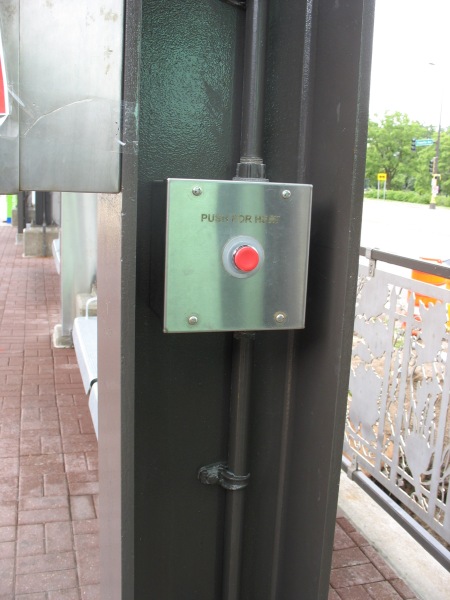
Cold?  Turn up the heat:

IMG_4431

Pushing the red button activates a space heater overhead.  Note the detail on the railing behind the post – there are several different patterns for the various stations.  There’s also work screened onto the glass of the windscreens:

IMG_4430

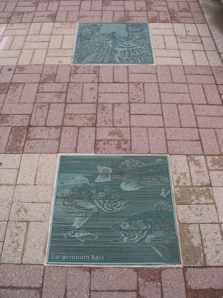
If you can’t tell (and I won’t expect anyone to at this resolution), that’s a long poem shaped in the silhouette of a tree imposed on the glass – that looks out over Hiawatha Avenue at some other nice trees in Minnehaha Park.  Minnehaha Park is the home to Minnehaha Falls, where the Minnehaha Creek cascades down toward the Mississippi River.  There’s some good fishing in the area, and the connection to wildlife at this station is emphasized with reliefs in the pavers:

IMG_4429

You gotta love the Largemouth Bass.

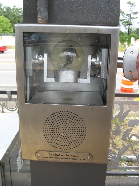
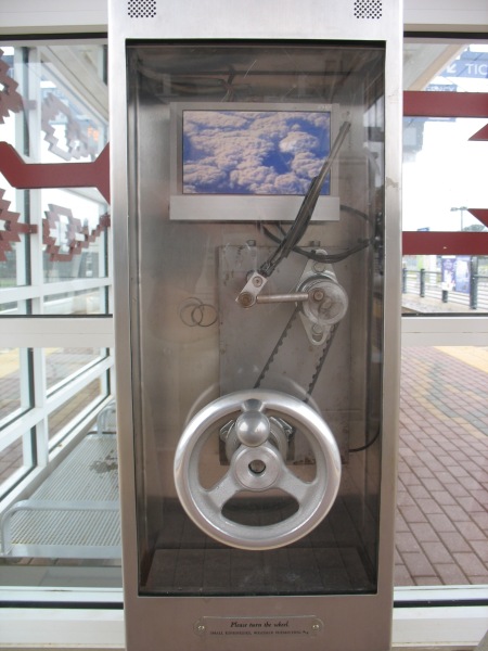
If those passive details aren’t enough to hold your attention, there are other entertainment options.  At stations along the line, there are multiple boxes labeled as “Small Kindnesses, Weather Permitting.” These are a public art installation by artist Janet Zweig:

This public project is an interactive artwork for 11 stations of the Light Rail. There are three or four small kiosks at each of the stations, 35 kiosks in all. There are 11 different kiosk designs: 7 audio designs and 4 video designs, made in editions of 3 or 4 each. Designs include a windshield wiper, a doorbell, a telephone, a curtained theater, a revolving snow-globe, a pinball game, and a “thanks a million” machine. Each unit has a mechanical initiator (like a hand crank, a push button, a lever) and a digital output — either audio only or video with audio. Each unit is weather-proofed, protected behind tamper-proof glass and enclosed in a steel box attached to a station column. The LCD monitors are heated for the cold Minnesota winters.

In the winter of 2003-4, we held a competition for Minnesota filmmakers, videographers, singers, storytellers, comics, etc, to provide content for the kiosks, all on the theme of weather or courtesy (“Minnesota Nice”), the two cliches about Minnesota. The collection of 114 audios and 78 videos were made by over 100 Minnesotans, the result of an open competition and ongoing solicitation of talent through suggestions from arts professionals in Minnesota. The clips last from 30 seconds to 3 minutes. They range from the comedic to the serious, from professional to amateur. On an ongoing basis, this content is delivered to the 39 units, activated when someone on the platform discovers the unit and activates the mechanical initiator. All content goes to every kiosk, providing visitors with always varying artwork while waiting for the trains.

IMG_4432

Go ahead and let it snow.

IMG_4485

The popularity of the line is self-evident both from the patrons and from the construction.  When initially built, several expensive stations (those underground or on aerial structures) were built to accommodate three-car trains, the theoretical max for the system.  All the remaining stations are currently having their platforms extended to meet the demand for three-car trains (a single articulated car is about 95 feet long, thus a three-car consist would be close to 300′ long total, just shy of a 4-car Metro train).

IMG_4428

Every station has a couple of platform information displays, as well.  However, the best these do is display rolling information (such as station closures – there were a couple on this day for platform extension work) and the time of day – as well as the vitally important information telling you that you’re riding the Hiawatha line.  No next train arrival time – perhaps one of the single greatest things about DC’s Metro stations.

You wouldn’t think this feature would be so difficult to implement…

IMG_4436

Catching Up

Isthmus of Madison, WI

Isthmus of Madison, WI

Lots of items worth commenting on over the last week.

High Speed Rail Notes: Several good posts, including the transport politic shooting down some of Ed Glaeser’s numbers on HSR, as well as potential high speed connections between New York and Montreal.  Improving connections to Montreal, Toronto, and Canada’s main mega-region is a no-brainer.

The Overhead Wire also notes some assorted quotes on HSR, including a link to a Madison paper on weighing the different station options – either out at Madison’s airport, or closer in towards downtown (though not fully downtown by any means).  Having spent many years in Madison for college, I can’t quite see the major advantages of the proposed Yahara station versus the airport one.

The problem stems from the fact that Madison is on an isthmus.  The only way to get rail service downtown is to have a stub end terminal there, which complicates things from an operational perspective, given that both the line to Milwaukee and any potential lines northwards to the Twin Cities would approach Madison from the East side.  Current rights of way have a near U-turn at the proposed Yahara station area, taking some park land (a park I used to play Ultimate in, by the way), but the platform would still be awfully short for long term developments, not to mention hugging a sharp bend in the track.

Ideally, Madison would have solid rail transit service operating along some of those rights of way in order to get quick service from the airport (or the Yahara station) to downtown.  The tracks are there, they could theoretically start operating commuter rail tomorrow with a few DMUs.

Too Much Parking: Chris Bradford has a series of posts on the perils of too much parking – one and two.  Post one puts the reasons too much parking is bad in a handy-dandy bullet format, while post two takes note of a nice chart from San Francisco based Liveable City:

Old New
Parking is a social good. Parking is not an entitlement.
More parking is always better. Too much parking can create problems.
Parking demand is fixed, regardless of price or transportation alternatives. Parking demand is elastic, and depends on price and the availability of transportation alternatives.
Governments should establish minimum parking requirements. Governments shouldn’t mandate parking, and should instead establish maximum parking allowances where they make sense.
Parking costs should be bundled into the cost of housing, goods, and services Parking costs should be unbundled from the cost of housing, goods, and services.
Parking is a burden to government, and subsidies to parking will compete with other priorities for available funding. Parking can be a source of revenue for government, and if priced correctly can fund other city priorities.
Parking should be priced to encourage full utilization. Parking should be priced so as to create some available spaces at most times.
Cities should use time limits to increase parking availability and turnover. Cities should use price to increase parking availability and turnover.

That’s a solid summary of the old thinking about parking, compared to the new school of thought.  Chris also notes that you can easily replace “parking” with “roads” and the list is still valid (though it may require some grammatical adjustments).

Miscellany:

  • ZipCar will get some competition in the hourly car rental market.
  • Summer Parks‘ are not the same as Summer Streets.
  • Miami’s zoning overhaul, entitled Miami 21, fails to advance.  This is a serious bummer for anyone who’s ever dealt with an arcane zoning code.
  • A token of my appreciation (har har) to Jarrett Walker for looking to abolish the $1 bill.  They’re a real pain in the ass for transit operations.   David Alpert mentioned equalizing Metrobus and Circulator fares, noting that the $1 Circulator fare seems to prioritize tourists over residents – but the whole idea of the Circulator is to be easy, and an even $1 fare is about as easy as it gets.  It would be even easier if we had Loonies (and, you know, it was culturally acceptable to use them).

DC's few old warehouses

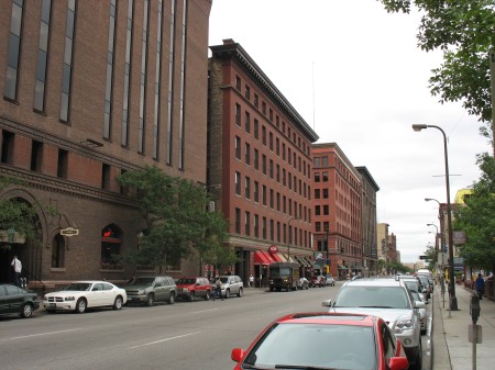
My trip back to Minneapolis offered a great chance to see and experience some great old urban warehouses.  Warehouse districts are common in many old industrial cities.  In Minneapolis, the old industrial aesthetic abounds – these massive brick structures hulk over the street, but offer a fantastic level of detail and craftsmanship.

IMG_4466

These warehouses sit along 1st Avenue in Minneapolis, probably the most prominent nightlife district within downtown.  That wasn’t always the case, as these warehouses were used as artists lofts and other more marginal uses (looking for cheaper rents) just 10 and 20 years ago.  They’re extremely versatile buildings.  Compared to their contemporary structures in the suburbs, I think it’s safe to say that we don’t build ’em like we used to.
As I was admiring these structures in Minneapolis, it was fitting that Noah Kazis had a series of posts about one of the few areas in DC that has a similar aesthetic.  DC never had the industrial legacy that Minneapolis did, thus it doesn’t have the same kinds of legacy buildings and warehouses.  There are a few exceptions in Georgetown, the Navy Yard, and along the rail lines behind Union Station – which was the focus of Kazis’ posts.  They are divided into three parts, focusing on the Government Printing Office, the Gales School, and a concluding post.

Kazis lays out the basic premise for these posts:

Between North Capitol and Massachusetts Avenue, G Street NW is a block of urbanist paradox. Two sites, the Government Printing Office and the Gales School, pose difficult to answer questions about the proper place for older, grittier urban uses in districts of modern office buildings. In a series of posts today, I’ll explore a block of D.C. that gentrification somehow passed over.

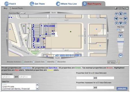
I’m not sure framing this as an example of spotty gentrification is the best approach.  For one, the entirety of this block, full of surface parking lots and the GPO, is all controlled by government interests.  A search on DC’s Citizen Atlas shows this:

GPO Plat Map

Those dark blue dots are all DC properties, and the green properties between 1st and New Jersey are owned by the Feds.  Given government ownership, you wouldn’t expect these blocks to develop.

Furthermore, I don’t think the lack of development along this block is all that unusual.  Certainly, the location is close to Union Station, but there was (and is) plenty of undeveloped land nearby under private ownership.  Proximity to Union Station hasn’t helped those properties any more or less – and development happening currently is in too narrow of a timeframe to really draw any conclusions.

Likewise, Kazis implies that the block has been encircled by gentrifying properties.  I don’t think that’s the case, either.  To the north, development is sparse, and what does exist is relatively new.  To the west, the Douglas Development Building is more the exception than the rule.  To me, the defining characteristic of that area is the massive barrier created by 395.  The Douglas Development building is more of an island within the sea rather than a contigous growth of redeveloped properties.  Other developments along H St NW are growing from the Chinatown area towards the GPO block, not the other way around.  If you want to look at gentrification as a blob increasing in size, I would argue there are two blobs approaching this area (one from Chinatown, one from NoMA), rather than one that’s enveloped it whole.

Kazis continues on the GPO:

The building is visually interesting and quite historic, but it is also visually hostile to street life. I work a block east of the GPO and my coworker just described that block as “just dead and ugly.” Would this section of NoMa feel more with the GPO replaced by another sterile new office building? Jane Jacobs would weep. The GPO building is also lower-density than much of its surroundings. If density would be increased by exiling jobs to the suburbs (where the GPO would inevitably relocate) would that be a net positive or negative? How comfortable should sustainable transport advocates be with telling 500 transit-riders their jobs are moving out of the city? Is this the mixed-use that we want and or the underutilization of space that characterizes struggling blocks?

I’m not sure what he’s getting at with the density argument – the GPO buildings are each 8 stories tall – plenty dense for urban uses.  As a whole, the site isn’t all that dense, but the surface parking could be easily redeveloped without hurting the GPO’s current configuration.
Kazis concludes:

I don’t predict that either the GPO or the Gales School will survive another twenty years. The GAO will conclude that efficiency calls for selling the GPO to private developers and relocating out of the city. The Central Union Mission will get an offer that a social service agency can’t refuse. And that block of G Street NW will feel more inviting, draw more people onto public transit, send more tax dollars to the D.C. government, and be one more part of a revitalized NoMa. It will be regrettable, even though it will probably be for the best. But we should change zoning, lift height restrictions, and do all the other things that would help us make this area vibrant and put more jobs near transit without needing to bulldoze the past for a downtown that equates health with sterility.
I’m not sure what Kazis’ concern is for the GPO building.  Even if the GPO leaves the area, the building will undoubtedly remain and will not be bulldozed, as the great warehouse districts in Minneapolis and other places show.  These old industrial warehouses are tremendously adaptable spaces.

Urban health need not equal sterility, but urban health also isn’t immune from the larger evolution of industrial practices.  Not only do we not build warehouses and vertical industrial spaces like this anymore, it’s unrealistic to expect those industries to use these ‘outdated’ spaces when it’s not efficient for them to do so.

Nevertheless, I don’t think these changes will lead to the demise of the GPO building.  These kinds of spaces are cherished in other cities, and given DC’s relative lack of that type of building and style of architecture, they should be cherised spaces and development opportunities here, too.

Robots

Apropos of absolutely nothing…

Ryan Avent delves into the subject of automation and robotic labor undermining low-skilled workers:

But this is silly. Why? Machine and robotic resources aren’t free; they’re resource constrained just like everything else is resource constrained. We have the tecnological know-how to replace millions of human workers with machines right now, but we don’t because the expense of building, programming, operating, and maintaining the machines is too great. It’s not worth it. As demand for human labour falls, the price of human labour will also fall making the hiring of humans more attractive. Meanwhile, as demand for robot labour increases, the price of robot labour will also increase (since the stuff robots are made of is scarce), making the use of a robot for any given task less attractive. There will then be some market equilibrium which will, in all likelihood, involve plenty of employment for low skilled workers.

That’s all well and good, but I’d still stock up on Old Glory Robot Insurance if I were you.

Minneapolis – LRT Vehicles

My semi-regular voyages back home to Minnesota afford me a great chance to ride Minneapolis’ sole light rail line, the Hiawatha Line.  It stands in such contrast to DC’s Metro – Metro is a system, this (currently) is just one line; Metro’s stations are all similar, while each Hiawatha station has individual designs; Metro is relatively old, Hiawatha is almost brand new.

Either way, it’s worth a ride. It even offers a few lessons for DC’s transit systems.

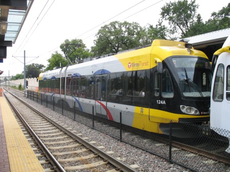
First, a look at the LRVs on the line:

IMG_4425

Many vehicles are fully ‘wrapped’ in rolling ads (such as the 2nd car in the pic above, just off the screen to the right).  Metro’s been doing some of this, but the vehicles are almost never fully encompassed by the wrap, and the fact that they’re in tunnels a great deal of the time means you don’t see giant ads rolling down the street.

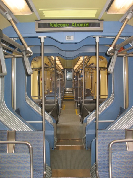
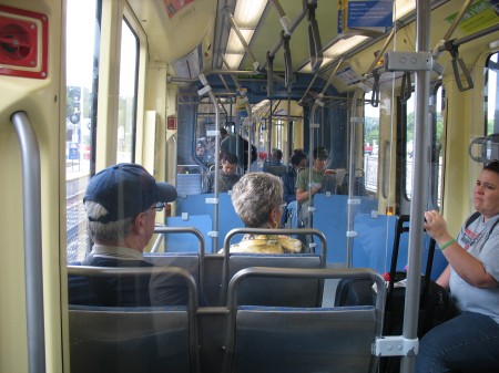
Inside, the cars are relatively spacious, connecting between the articulated portions:

IMG_4479

Just make sure you don’t lean on the bellows

IMG_4483

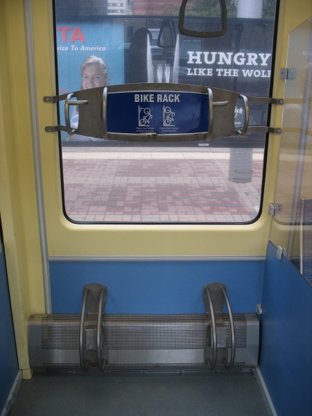
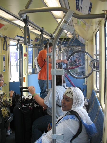
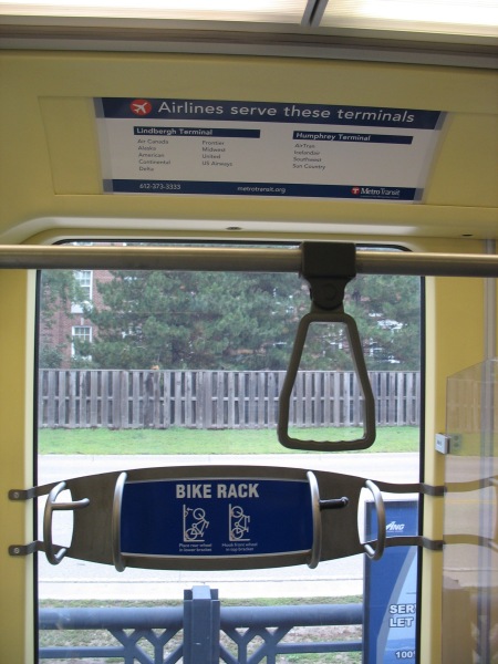
The cars come complete with bike racks, which were well utilized during my weekday rides.

IMG_4478

(also note that the tint on the window in this picture is the interior of a rail car with an ad wrap on it – you can still see out fairly well)

IMG_4439

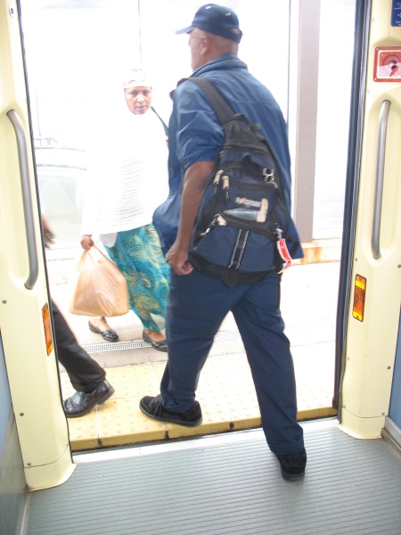
All of the cars have low floors and level boarding with the platforms:

IMG_4438

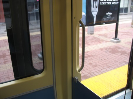
The doors on the cars also push outward towards the platform and then slide to the left or the right, allowing for windows in the vehicle to come right up to the edge of the doors.  Many armchair transit operators wish Metro had more and/or wider doors, but with their current configuration, that would also mean fewer windows on the train – making it harder to see stops, signage, etc.  Might this work in a subway setting? Then again, given the rate at which Metro doors break, adding more complexity to the mechanisms probably isn’t the best idea…

IMG_4481

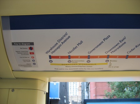
Line signage also offers information on connecting bus routes available at each station, travel time between stations, etc:

IMG_4480

This kind of information can be easily displayed in a static medium (as seen here) on a one-line system, but covering all this information on a much larger system such as Metro is effectively impossible with static signage.  However, the 7000 series railcars will feature LCD displays in each car.  WMATA’s documents indicate those displays would show the “Metro channel,” presumably something similar to the new replacement platform displays they’d like to see.  However, such variable displays would also be able to show information like this, varying depending upon which line the car is serving at that particular time.  DCist at least hinted at the possibility of these LCD displays showing “interactive maps.”

Speaking of signage, the Hiawatha line aims to correct one sore spot of patrons flying out of MSP International – telling you which airlines serve which terminal:

IMG_4487

For those unfamiliar with MSP, each of the airport’s two terminals have LRT stations.  Since the line opened, the smaller Humphrey terminal has seen an increased role in airport operations.  LRVs travel between the two stations 24 hours a day to provide the official circulator between the two, should you need to transfer from one gate to the other (no matter how rare this is).

IMG_4437

Like Metro’s original interior color scheme, I’m not sure this one will stand the test of time – but it’s a functional layout and seems to be well recieved in a region that doesn’t have a strong transit-riding culture (yet).