Tag Archives: Metro

WMATA Infill Stations: Berwyn & New Hampshire Ave

The single-highest scoring infill station location from my back-of-the-envelope comparison was Berwyn, thanks to good transit connections, strong land use and development potential, as well as relatively easy construction. Infill stations at Kansas Ave or New Hampshire Ave are also common among crayonistas.

Berwyn

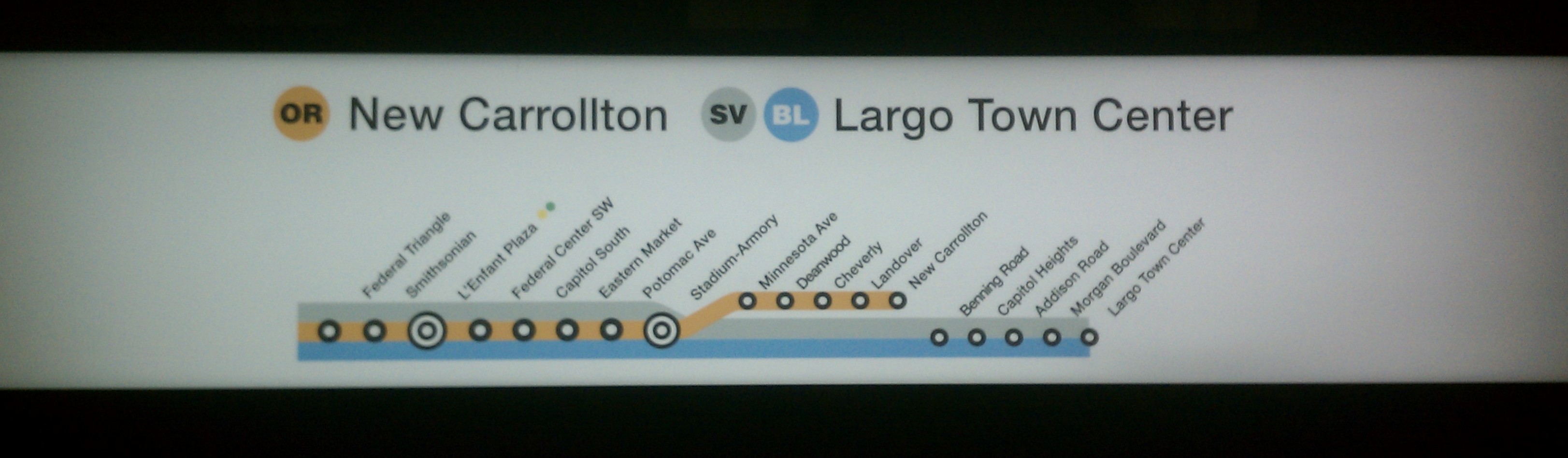
At first glance of a map, there’s a strong case for adding an infill station on the Green Line between College Park and Greenbelt. The two existing stations are 2.3 miles apart. The only road crossing the tracks in that span is Greenbelt Road, approximately halfway between the two stations.

I’ve opted to call this location ‘Berwyn’ due to the proximity to the Town of Berwyn Heights, and because the name would fit well as a unique addition to WMATA’s station name, but we’re talking about a station to be built near where Greenbelt Road crosses the tracks.

The wide right-of-way includes three Metro tracks and CSX’s Capital Subdivision (home to MARC’s Camden Line). WMATA’s third track isn’t used for regular service, but for testing new railcars, which are usually delivered to the system’s Greenbelt Yard.

View of the tracks, looking south from Greenbelt Road. Metro tracks on the left, CSX/MARC on the right

Connections: Because Greenbelt Road is a bit of a choke-point in crossing the railroad tracks, it already hosts a fair amount of bus service. Additionally, many of the routes traversing Greenbelt Road eventually turn north to terminate at Greenbelt Station, adding time and distance to a journey that could be shorter – if only there were a station where Greenbelt Road crosses the tracks.

Connecting bus service at Greenbelt station. Note all the routes feeding from the south that use Greenbelt Road.

Land Use: The Berwyn location is already seeing transit-oriented development with the townhouse project just north of Greenbelt Road – but it’s counted as part of the Greenbelt station development, despite the fact you can’t really walk between the two.

However, there are great development opportunities next to an infill station. Immediately to the west is the University of Maryland’s Severn Library, a high-density storage facility located in a former Washington Post printing plant. The site includes ample surface parking lots, ready for redevelopment. To the east is Beltway Plaza mall, already planned for additional housing. And in between, lots of properties fronting on Greenbelt Road are ripe for suburban retrofits and incremental additions of density.

Ease of Construction: The big reason Berwyn scored as the best overall infill station opportunity is because of (hopefully) easy construction. The right of way is generous; there would seem to be opportunities to add platforms with minimal track reconfiguration; or, use the generous spacing to reconfigure the tracks to make room for an island platform. Regardless of the design, the available space opens a lot of doors.

An ideal configuration would link mezzanine access directly to the Greenbelt Road bridge, allowing for easy bus-to-Metro connections and simple pedestrian access. Some additional work is required to create welcoming walking environments.

New Hampshire Ave

Should we call this spot Kansas Ave? New Hampshire Ave? That’s part of the conundrum. You can’t really do both, you’d have to pick one. And each avenue has big drawbacks.

Station location (orange rectangle) shows the Kansas Ave location

The context here is a 1.8 mile gap on the Red Line between Fort Totten and Takoma stations. Adding a station at either Kansas Ave or New Hampshire Ave would be plausible.

Connections: existing bus service shows a clear preference for connections at New Hampshire Ave, which hosts WMATA’s K6 and K9 Metro Extra routes. Kansas Ave, by contrast, is home to only the modest K2 bus, with just 22 round trips per day.

Land Use: a quick glance at a Google Maps aerial shows why NH Ave has the bus service: Kansas Ave terminates at the DC line, whereas NH Ave turns into a major suburban commercial strip.

However, within the District, the situation is reversed: Kansas Ave is surrounded by industrial uses and potential redevelopment sites, while NH Ave is hemmed in by parkland and steep slopes before you hit existing single family residential areas.

DC has a interest in protecting some industrial sites; but doing so is incompatible with adding a new Metro station, which will basically require high-density land use.

DC Future Land Use Map on left; Aerial Photo on right

Ease of Construction: this is the real challenge for either location: it would be a massive construction project – something on the scale of the original construction of the Red Line itself.

The Red Line is sandwiched between two tracks of CSX’s Metropolitan Subdivision. Building Metro required a complete reconstruction of the entire rail corridor; WMATA used the center of the ROW to preserve freight rail access to sidings along the route – most of which have since been abandoned.

Adding platforms at either location requires relocating the CSX tracks at a minimum, and perhaps the WMATA tracks as well (depending on platform configuration). Additionally, the New Hampshire Ave location is amidst a slight curve, further complicating construction.

Either location would be expensive, decreasing the prospects for these locations. However, the Kansas Ave location would seem to be the more challenging site, requiring rebuilding the existing underpass, acquiring adjacent properties, etc. The existing NH Ave overpass provides a bit more margin, but still presents a tight fit.

WMATA Infill Stations: Oklahoma Ave and River Terrace

Because of the challenges in adding underground infill stations, most candidates are going to be at grade or above ground. Almost by definition, that means fewer opportunities for infill stations around the core of the system, and therefore within Washington’s city limits.

The existing system features a huge gap as the Orange/Blue/Silver lines cross the Anacostia River. The east of the river stations (Minnesota Ave and Benning Road) are both two miles from Stadium-Armory.

Filling this gap is not a new idea – early WMATA plans called for stations at both locations. Oklahoma Ave was on the books long enough for renderings to be drawn up.

WMATA Adopted Regional System, 1968

WMATA originally considered the area next to the Benning Road Power Plant for a rail yard (the “S&I” oval on the map above, for service and inspection). The adjacent Kenilworth Ave station eventually moved east and became Minnesota Ave.

These two sites are unique in that they do not parallel any existing railroad services, where future regional rail might offer faster, longer-distance service, allowing Metro to focus on shorter distance travel markets. Part of the argument for more infill stations, particularly in the suburbs, is the promise of regional rail. However, these two locations do not need that promise to fulfill their roles – they offer compelling visions on their own.

Oklahoma Ave

Metro planners envisioned Oklahoma Ave as a park and ride station, taking advantage of the extensive surface parking for nearby RFK Stadium on non-event days. The nearby Kingman Park community vociferously opposed a parking-focused station, and WMATA eventually dropped the station in 1977.

1970 Rendering of elevated Oklahoma Ave. Station

Adding an infill station at Oklahoma Ave would likely follow the same concept from the 70s: two side platforms along the existing elevated guideway.

Connections: Potential transit connections from Oklahoma Ave are relatively weak. Almost all transit is located just north along Benning Road, including the DC Streetcar as well as extensive bus service. It wouldn’t be difficult to extend those lines to connect with the station, but the expense (and ongoing time penalty for bus riders) for doing so would depend on the broader plan – if Oklahoma Ave were built together with a River Terrace station, the latter could offer superior transit connections.

Land use: This is another challenge for the area. The immediate surroundings are the northern parking lots for now-vacant RFK Stadium. A large portion of those parking lots are now athletic fields. The parking lots were originally created by filling in the Anacostia’s tidal marshes. As a result, the entire area is within the floodplain, and unlikely to ever be developed as housing or office.

Redevelopment of the remainder of the RFK site outside of the floodplain is a contentious topic with complicated jurisdictional issues yet to be resolved. If the site were to return to a stadium/venue use, the ability to disperse crowds to multiple Metro stations would be a potential advantage.

Without an intense use at RFK, the rationale for Oklahoma Ave is less clear, particularly if River Terrace were built. However, if RFK Stadium were to be redeveloped as some sort of venue with large crowds, then the case for Oklahoma Ave is much stronger.

Ease of Construction: The biggest benefit at Oklahoma Ave is that construction ought to be easy – existing elevated track in the middle of a parking lot. The potential complications would involve any operational changes to the existing line, and determining any role for this location in future Metro expansion plans.

River Terrace

An infill station at River Terrace presents a tantalizing opportunity. The existing tracks are located at a key chokepoint and river crossing, served by one of the busiest bus lines in the city. The existing neighborhood to the south of Benning Road is isolated, separated from the rest of the city by the river to the west, DC-295 and the railroad tracks to the east, and the former Pepco site to the north.

Connections: Benning Road serves as a critical choke point for transit service, making it a great candidate for improved infrastructure. Lots of bus services cross the river here; the nearest crossing to the north (US-50) is along a freeway, and to the south (East Capitol Street) lacks good service. The DC streetcar terminates just to the west, with longstanding plans to extend it along this stretch of Benning Road.

In the future, the H/Benning corridor has long been targeted for Metrorail service. One of the longstanding concepts would be the “separated Blue line,” a new trunk line through the District to separate out existing Blue Line services from Orange and Silver services. Such a vision ought to include River Terrace as a four-track station enabling cross-platform transfers.

WMATA is currently in the midst of their ‘Blue/Orange/Silver’ study. The concepts released in 2021 did not include a new connection at River Terrace. These larger network designs will impact the kind of infill station design for River Terrace.

DC’s once-ambitious streetcar plans have been substantially curtailed. However, the one extension still officially on the books (though controversially) is the Benning Road extension, passing through the River Terrace site. One rationale for the extension is to connect the eastern end of the streetcar line to something, preferably a Metro station. However, because of the D&G junction, splitting Metro service along the Orange Line and Blue/Silver lines, connecting at Benning Road means losing the value of connections for Orange Line passengers.

Benning Road Streetcar Extension Plan – adding a Metro connection at River Terrace (34th St NE) improves connectivity for all users.

Land Use: Immediately adjacent to the station site is Pepco’s now-demolished Benning Road Power Plant site. The plant was demolished in 2012, and in later years was only used during peak periods of demand for a few days per year.

The plant was once the source of a huge amount of pollution, particularly in the Anacostia riverbed. Large-scale remediation and clean-up will be needed before redevelopment is feasible. Additionally, the site retains electrical distribution infrastructure and support for Pepco operations.

Despite all the challenges, it’s a 70+ acre site in the middle of the city with (potentially) excellent transit connections.

Ease of Construction: Compared to Oklahoma Ave, just adding platforms to the existing elevated section would be extremely complicated.

First, this section of track includes the notoriously unreliable D-route pocket track. The pocket track was originally slated to turn terminating Silver Line trains, but WMATA determined it was not suitable to serve that purpose reliably, and investigated alternative designs.

Second, the location of the pocket track (the straightest section) extends over the Anacostia River. Furthermore, the track itself is immediately adjacent to the Benning Road right of way, requiring some combination of road and bridge relocation or a station cantilevered over Benning Road.

Any design with side platforms ought to consider the possibility of a new Blue Line connecting through this location. The ideal design would allow for a future cross-platform transfer between the existing tracks and future Blue line services.

Third, Benning Road itself provides an opportunity for a creative and efficient passenger transfer from Metro to buses and streetcars. Doing so will involve extensive reconstruction in the area, meaning this won’t be a simple infill station – but the opportunity is too large to pass up.

There are lots of examples of efficient transfers between streetcars and rapid transit. Toronto is full of them, such as this one at Dundas West.

St. Clair West is another, featuring a fully-integrated streetcar and bus transfer loop built around (not just next to) the entrances to and from the subway. Passengers can transfer easily while protected from the elements and with minimal walking distance.

(side notes: Dundas West includes a small McDonalds, hitting on another minor obsession of mind, in-station retail. Also, do check out the excellent Station Fixation blog for a full visual tour of the entire Toronto system)

At River Terrace, this might involve diverting the streetcar tracks off of Benning Road itself to encircle a ground-level mezzanine for the Metro station, offering quick and direct transfers for passengers moving between modes.

Crayon Plans – WMATA Infill Stations

Adding stations to the existing Metro system is a plausible way to expand the transit system without some of the costs involved for new routes. The region has a modest track record for infill stations – the NoMa station opened in 2004, and the Potomac Yard station is set to open in 2022.

Both NoMa and Potomac Yard share several characteristics: above-ground tracks passing through formerly industrial areas ripe for redevelopment.

Potomac Yard Metro Station under construction, August 2021 – photo from Wikipedia

Some criteria for infill station sites:

  • Ease of construction: Above-ground locations are the only feasible sites. Lots of planners and crayonistas call out the possibility of below-ground infill subway stations, something that (to my knowledge) has never been done without accommodations for a station from the start.
  • Potential surface transportation connections: connecting to arterial streets that can carry connecting bus transit, as well as walkable street networks is vitally important.
  • Redevelopment opportunities: these places were bypassed for stations for a reason. Plausible transit-oriented (re)development sites and planning are critical elements.

As it happens, the kinds of places that meet these criteria are often the parts of the network already parallel to existing commuter rail lines. Overlapping services opens the door for additional infill stations on the Metro network.

Let’s imagine a future world where the DC region’s commuter rail systems have been integrated into a coherent regional rail network offering rapid transit service. Even compared to WMATA’s already lengthy suburban routes, those networks extend well beyond the end of the current system. Commuter rail evolves into regional rail; and WMATA (conceived as a hybrid between regional rail and urban rapid transit) evolves further along the rapid transit spectrum.

Based on those criteria, I have twelve possible infill station sites on the existing WMATA network. Many are aspirational, particularly in terms of land use.

Here’s the list:

Location: State:Services:
Franconia RoadVA🔵
Eisenhower ValleyVA🔵
New Hampshire AveDC🔴
BerwynMD🟢 🟡
Edmonston/WoottonMD🔴
Montgomery CollegeMD🔴
Gude DriveMD🔴
Centerville RoadVA⚪️
Oklahoma AveDC🔵 🟠 ⚪️
River TerraceDC🔵 🟠 ⚪️
Wolf TrapVA⚪️
Slaters LaneVA🔵 🟡
Potential WMATA Infill Station Sites

Some of these sites are opportunistic. That is, the site could support an infill station built at a reasonable cost, even if the land use (both current and future) aren’t likely to change much. Franconia Road is one where adding some platforms to existing track ought to be an easy task (with the caveat that nothing in American transit construction is easy at the moment).

Others are targeted at potential large-scale redevelopment of low-density land uses. And some (e.g. Wolf Trap) are longstanding ideas that might not make much sense, but I’ve included them here anyway.

Take the three criteria above, and score each on a 1-3 scale (with 3 being the best) and this is the back-of-the-envelope ranking:

These twelve additional stations (in addition to the 98 currently open or under construction) have the potential to increase the system’s ridership. Each additional node in the network can increase the value for the network as a whole, particularly given the redevelopment prospects for the region.

Some caveats: Obviously, I’m just spitballing here. The ‘ease of construction’ is all relative, and leaving aside the larger issues of transit construction costs for the time being. Controlling costs will be critical to making any additional infill stations feasible, yet alone stations with marginal scores.

Still, all but one of these locations are above ground, and the one that’s in a tunnel is a short cut and cover segment. There’s precedent for building stations in this way.

I hope to go through the details of each station area in future posts…

Four Years of Tracking my Metro Trips

Not much has changed, and yet everything has changed.

The last two years have been… unusual to say the least. With the pandemic, lockdown, and working from home, I overhauled my commute, just like many others. And my Metro data tells the tale:

Four years of Metro Trips, logged

You can see the exact moment when the world shut down. From mid-March 2020 through Mid-January, 2021, I took a grand total of seven unlinked Metro trips. By mid-march 2021, I had resumed a new commute pattern, mostly for the purposes of daycare drop-off.

Metro during the pandemic has been different. 92.4% of my trips in 2021 have been on a 7000 series train, and the remainder have been on 3000 series. I haven’t ridden either a 6000 or 2000 series train since the pandemic began.

Some trivialities:

  • The entire 7000 series fleet is in service, and I snagged a ride on the newest car (Number 7747) on August 17, 2021.
  • Of the current fleet, I’ve ridden 1137 of the 1284 cars in service (what counts as “in service” is a bit of a moving target), or 88.6%
  • My most frequently ridden car is 7673, which I’ve caught ten times over four years.
  • The longest gap between cars I’ve managed is 1,382 days, on car 7111. That’s 3.78 years of the current 4 year timespan.

With life changes, so to will my commute patterns. The ‘new normal’ remains uncertain for balancing working in the office vs. working at home. My kid is now attending a school within walking distance. I’ve felt comfortable on transit during the pandemic with a mask and with relatively sparse crowds, but the pandemic’s continued impact on travel demand is painfully uncertain.

Who knows what the next year will bring?

Two years of tracking my Metro trips

Two years ago, I started tracking my WMATA rides for extremely trivial reasons. After a while, my curiosity is now ingrained as a habit, a small bit of gamification of my commute (even if that game is basically Calvinball).

(Since I originally started doing this to see how quickly I would ride in the same car, I should note that on three occasions, I’ve ridden the same car twice in one day. The longest gap between rides on the same car is 707 days between rides on car 3230.)

With two years of data in the books, I thought I’d share some highlights: 2,013 unlinked trips, using 986 unique railcars, covering about 73% of the current fleet. Seventy five of those cars will never be ridden again, retired as part of the 5000 series. From the current fleet, there are 333 cars I’ve yet to ride, and an additional 113 that have been retired before I had a chance to ride. The fleet makeup is constantly evolving as Metro continues to accept new 7000 series cars, so the precise numbers change often.

My obsession has provided means to monitor the introduction of the newest members of the 7000 series, with 706 cars of the 748 ordered now in service.

Beyond changes in the Metro fleet, I’ve been able to document changes in my own life – different daycares, different jobs, and different commutes. I’ve also noticed how Metro changes their operations and railcar assignments as they take on major track work and as their fleet evolves.

Some charts:

Most of my trips are commute trips; red bars correspond to WMATA’s peak fare periods.
I’ve ridden all but 2 of the 2000 series cars that are in service; I rode 75 of the 5000 series before they were retired.
More than half of my rides have been on 7000 series trains.
My regular trips make frequent use of all services except for the Red Line. Most trips are still tied to the Orange/Silver/Blue lines, serving my home station.

I was also curious if I could put two years of tracked trips into one chart, so here’s an annotated version:

You can see the retirement of the 5000 series cars, the slowly increasing size of the 7000 series fleet, re-assigment of cars around the system, particularly in response to this summer’s lengthy Platform Improvement Project shutdown. The retirement of most of the 5000-series fleet also shifted the 6000 series – previously common on the Green line, but then shifted to the Orange/Blue/Silver lines.

You can also see how some cars tend to stick to certain portions of the system. This is easiest to see with the Red Line, since it’s both the most isolated from other lines and the line I ride the least. Before the PiP, you can see how most 3000 series cars with numbers above ~3175 were assigned to the Red Line. Likewise, most 7000 series trains between ~7150 and ~7300 are also isolated on the Red Line, except for a few weeks during this summer’s shutdown.

One year of tracking my Metro trips

Three months wasn’t enough for me, I needed to spend an entire year compulsively tracking my Metro rides. I know I’m an outlier on this, but it’s been a fun way to ‘gamify’ my commute.

Some fun facts from a year on the rails:

  • The newest car: 7547 (August 30, 2018)
  • The oldest car: 2000 (November 9, 2017)
  • Most frequent car: five trips on 5088, interestingly all of them Orange Line rides.
  • 882 total unlinked trips
  • 592 unique railcars; of which:
    • 373 I’ve ridden in once
    • 160 I’ve ridden in twice
    • 48 I’ve ridden in three times, etc…

Or, to put it in visual terms:

Screen Shot 2018-09-24 at 2.21.41 PM

Given the ever-shifting total size of the fleet (thanks to both new car deliveries and old car retirements), my best guess is that I’ve ridden at least once in 50.8% of the WMATA fleet over the past year.

Screen Shot 2018-09-24 at 2.22.00 PM

Some fun observations:

Lots of 5000 series cars are now out of service. Some reporting suggests only 62 out of the original 192 5000 series cars remain in service. I’ve recorded trips on 75 unique 5k cars, some of which are surely retired by now.

Screen Shot 2018-09-24 at 2.22.21 PM

Railcar types are not evenly distributed across the network: Of my total rides (opposed to unique rail cars), 41% are on 7000 series train, an increase from my trip share after 3 months. Some of that is surely due to 5k car retirements and ongoing 7k deliveries, but some might also be due to my changing commute and because the railcars are not evenly distributed across the entire network. 

For example, a large portion of the 3000-series fleet appears to mostly stay on the Red Line. I’ve recorded lots of trips on cars in the 3000-3150 range (none of them on the Red Line), and far fewer on 3150+.

I ride the Red Line the least often, and thus don’t often encounter those cars, and given that the Red Line is the most isolated in the network, I’m not sure how frequently those cars ‘migrate’ to other rail yards.

Midway through this year, my toddler started at a new daycare located on the Green/Yellow lines. My old commute, both to/from work as well as daycare, was located entirely along the Orange/Blue/Silver trunk. And while the 7k cars are used all over the system, riding the Green Line more often sure seems to mean more rides on 6k trains (only 9.2% of my rides in December; compared to 16% now).

Screen Shot 2018-09-24 at 2.28.35 PM

Unlinked trips by Line

Adding in more Green/Yellow trips subtly changes the fleet mix. My rides on the Green Line are almost exclusively on 6k or 7k trains. The only exception (for two trips) occurred during the concurrent Major Improvement Projects on both the Red Line and the BL/OR/SV between August 11-26 2018, which surely scrambled all sorts of fleet practices.

Screen Shot 2018-09-24 at 2.29.06 PM

Railcar share by Line; total trips by line at the top

I ride least frequently on the Red Line, but even that small sample shows a pattern of only riding 7k and 3k cars. Likewise, some of the 3000 series cars on the Red Line tend to stay there.

Screen Shot 2018-09-24 at 2.29.47 PM

The vast majority of my trips are weekday trips. My weekend use has dramatically declined. Part of that is certainly my lifestyle, pushing a stroller around. But poor weekend service with extensive track work doesn’t help.

Still, fare policy impacts my rides. Since obtaining the SelectPass, I find myself far more likely to take incremental short trips. For example, a two stop rail trip just to beat the heat instead of walking? No problem.

Methodology:

I use a simple Google form to collect the data. I only collect two bits of information via the form: the car number and line color (I do also have an open-ended text field for any notes). Submitting data via the form adds a timestamp. This helps minimize the data input.

I considered adding additional data fields, such as origin/destination station, but opted not to do so. As a result, I don’t have any information on fares, delays, most frequent stations, etc. 

I collect data on unlinked trips, so any single journey with a transfer is recorded as two unlinked trips. I’ve also (occasionally) moved cars on a single trip due to a hot car, and those trips are recorded as unlinked trips.

Also, my riding habits are not random. Aside from my regular commuting routes, I’m often riding to or from daycare with my toddler. Traveling with a stroller puts open space at a premium, which means I’m more likely to pick the 7th and 8th cars on the train when riding with the stroller. This might not matter much with the older railcars, but might skew the data a bit with the 7000 series and the A/B cars. 

Seeking clarity on WMATA transit governance – operations vs regional funding and coordination

WMATA logo on a 7000-series seat. Creative Commons image from Kurt Raschke.

WMATA logo on a 7000-series seat. Creative Commons image from Kurt Raschke.

It’s not easy to do two things at once. Particularly when you have two very different tasks, one might get more attention than the other – or the goals for each might blur together in your mind.

Keeping these tasks distinct is a challenge. Jarrett Walker often speaks about the distinction between transit systems that focus on providing coverage vs. maximizing ridership, and the importance of thinking clearly about the two goals.

The current public dispute among WMATA’s Board of Directors about the preferred qualifications for a new general manager exposes a similar rift – with some members preferring to focus on a seasoned public transit executive (an operator), and others looking for a business-oriented financial turnaround manager.

As a transit agency, WMATA has to fill several disparate roles (thus the search for a single leader with super-human capabilities):

  • Operate regional and local bus transit, as well as the regional Metrorail system
  • Coordinate regional transit planning
  • Provide a regional transit funding mechanism

The latter two tasks (planning and funding) can be somewhat grouped together. WMATA’s Board of Directors is therefore charged with two rather disparate tasks: to oversee the day-to-day management and operations of a large regional rail and bus system; and to coordinate and fund that system across three state-level jurisdictions.

These disparate roles present plenty of challenges for WMATA’s leadership – just look at this list of tasks facing WMATA’s future GM, ranging from safely operating the system to uniting the region. Piece of cake – anybody can do that! Super heroes need not apply.

Absent any regional government, the WMATA Board has no choice but to act as a proxy for a regional legislature. While state-level governments might be anachronisms, they’re also not going to disappear anytime soon. Twitter-based WMATA reformers will call for ‘blowing up the compact’ and replacing it with… something. Aside from the Federal government, an inter-state compact is the only form of cross-border regionalism we have available to us. Others call for direct election of Metro board members. It’s an intriguing idea – BART’s board members are elected – but BART only operates a regional rail system. There’s only one elected regional government in the US, and it is wholly contained within a single state.

The medium-term fiscal outlook for WMATA shows an unsustainable trend of rising costs and stagnant ridership and revenues. These trends have stressed the agency’s business model, which requires member jurisdictions to pitch in to cover the annual operating subsidies.

However, the most recent breakdowns in WMATA’s reliability demand greater oversight on the agency’s primary task: safe and efficient operation of the regional transit system.

Instead of arguing about the preferred qualifications for a general manager, this dispute should open the door for a broader conversation about the system’s governance and how it can best tackle the different tasks as a transit operator and as a regional governing body.

During WMATA’s last crisis and most recent round of governance reform proposals following the 2009 Red Line crash, David Alpert hit on the challenges of the different roles for the WMATA Board. Given the different needs, David went so far as to suggest two separate boards for WMATA. Too many reform proposals seemed to talk past the different tasks required of the agency’s leadership – operational oversight and regional coordination.

The idea isn’t unprecedented. For example, in Paris, the Syndicat des transports d’Île-de-France (STIF) is the regional entity that coordinates planning, funding, and operation of transit in the region, and oversees the performance of the various transit operators it contracts with.

STIF negotiates with operators, holding them to performance-based contracts. In Paris, there are two primary rail operators – RATP, operating the Paris Metro, and SNCF, operating most of the RER and suburban trains. STIF also contracts with various bus operators.

The European Union issued mandates for how transportation companies must organize themselves, but the arm’s-length contracting between the regional planning body/coordinator and the local operators pre-dates these EU models. While these mandates for privatization and separation of operations from infrastructure are intertwined with this governance model, they remain a separate issue.

The idea of keeping operations and regional funding/planning at arm’s length seems to help sharpen the focus on accountability. It remains to be seen if the competitive tendering of contracts between transport associations and operators results in meaningful competition – after all, these kinds of systems are natural monopolies. But these contracts do indeed codify the relationships between the regional governance system and the operator, opening the door for maintaining accountability.

In these examples, the governance structure helps provide clarity about the roles and responsibilities for each participant in the system.

The importance of more & wider doors for future Metro railcars

CC photo from Stephen Evans

CC photo from Stephen Evans

This week, WMATA awoke to a nice present sitting under the tree. The first of the 7000 series railcars is here. These new cars will expand the fleet, increase the system’s capacity, and replace the oldest railcars in the system. All worthy ends, and all goals that the 7000 series will help meet.

However, like the economists pondering the economic inefficiency of Christmas, I can’t help but wonder what the 7000 series could look like if the gifts under the tree were exactly what you wanted. In that regard, the 7000 series design falls short. The good news is that there will be more railcar procurements in the near future.

The key shortcomings of the 7000 series are not technical (yet! we will need to see how they perform once in service), they are based on policy and assumptions about what a WMATA railcar is. Engineering-driven technical changes include a slight repositioning of the door locations and improved car body crash energy management.

At the same time, the assumption of the car design is to avoid changing the fundamental WMATA rail car concept (three doors per car, lots of seating for a commuter/metro hybrid). This means that the aesthetic changes to the 7000 series aren’t just about the end of Metro Brown. The altered door spacing and adherence to the original concept (three doors per car, three windows between each door) makes for awkward proportions – all in the name of leaving the original concept unexamined.

The good thing about assumptions is that they’re easy to change — once you change your mind. In California, BART struggles with the same legacy of operating a rapid transit/commuter rail hybrid. Despite the shortcomings of BART as a planning/construction agency, BART the operating agency is moving in the right direction. BART’s new rolling stock makes a couple of big changes, such as adding an additional door per car, embracing the rapid transit reality for the system.

Embracing the status quo is easy for any institution. That inertia is hard to overcome. Contrast BART’s changes to the most recent railcar procurement in Chicago, where the biggest changes are in the technical systems and seating layout.

I outlined some key ideas for the 8000 series in a previous post, but I wanted to put some numbers together to make the case for one of the most visible changes: wider doors, and more of them. The chart below summarizes the key dimensions from a selection of railcars:

Railcar Door Comparison

A Google docs spreadsheet with the above data is available here.

I chose the cars on this list for a variety of reasons. I mentioned RATP’s MP-05, used on the now fully automated Line 1 in Paris, and Toronto’s Rocket in a previous post. BART’s inclusion shows both old and new cars, demonstrating what can be gained from change. Using BART as a comparison point for WMATA is also useful due to the similar age and history of the two systems. And, as a counterpoint of traditional mass transit, I included examples of relatively new cars from New York’s A and B division.

Each of these examples represents a somewhat pragmatic choice; I wanted to include others but could not easily find online specifications on door opening widths. Basic dimensions on car/train length is easy to find, but door opening width is harder. Transport for London is one exception, with excellent online information from the agency itself, rather than from third parties. London’s new S7/S8 cars would be a good example to include, but TfL has not yet updated their rolling stock information sheet to include them.

Online sources:

The table shows  the impact of both the total number of doors, as well as the width of the doors. WMATA’s 50 inch doors are relatively narrow; all of the other examples are at least a few inches wider. The one exception is New York’s R160, but the R160 makes up for those narrow doors with overall numbers: Four door openings per 60′ rail car, compared to WMATA’s three doors per 75′ car. Each door on the MP-05 in Paris is 1.65 meters wide, showing how wide you can go – wider than WMATA by more than a foot.

The big reason to add doors is to improve/reduce station dwell time. The rightmost column illustrates the benefits of many wide doors: more space available to move between the train and the platform. When an 8-car WMATA train arrives at a platform, passengers must squeeze into 16.67% of the train to board/alight. Contrast that to the MP-05s used on Line 1 in Paris, where 32.9% of the train is available for passengers to pass through from train to platform. To put it another way, if WMATA wanted to offer that same permeability between the train and platform without changing door width, they would have to double the number of doors.

Line 1 in Paris is an exceptional case, where RATP is attempting to squeeze every last bit of capacity out of century-old tunnels. In the traditional rapid transit cases, each of the New York examples is greater than 25% door width to platform length. Toronto’s Rocket shows what WMATA would need to do to get to that standard: four doors per car, and modestly widen the doors to ~60′ per opening.

BART’s new rail cars won’t achieve the 25%+ of Paris, New York, or Toronto; but adding the third door to their new rail cars will beat WMATA at 19.3% and offer a substantial increase from the two-door model.

A simple re-evaluation of what WMATA’s assumptions about what a  rail car is can go a long way towards the goal of maximizing the capacity of the existing system.

Signs that the Silver Line is coming…

As WMATA prepares to take control of the first phase of the Silver Line from MWAA (with the exact handover date yet to be determined), signage for the new service is starting to pop-up around the system. WMATA is trying to raise awareness about the new service and new track with a dedicated website; you can see a presentation to the WMATA Board on their Silver Line activation plan here.

Some rail stations include strip maps on the station wall signage and on platform pylons. Others include backlit strip maps located above the on-platform map/advertising panels. In several stations, these maps have been updated with new Silver Line information:

Backlit strip map above one of Metro's platform ad panels at the Federal Triangle Station. Photo by the author.

Backlit westbound strip map above one of Metro’s platform ad panels at the Federal Triangle Station. Photo by the author.

Backlit strip map at Federal Triangle, including Silver Line to Largo. Photo by the author.

Backlit eastbound strip map at Federal Triangle, including Silver Line to Largo. Photo by the author.

In recent months, WMATA has installed new wall signage in Blue/Orange stations. The signage included awkward spacing for the lines/destinations, preserving space for the future inclusion of Silver Line services:

New wall signage on the westbound track at Eastern Market, with room for Silver Line information below OR and BL. Photo by the author.

New wall signage on the westbound track at Eastern Market, with room for Silver Line information below OR and BL. Photo by the author.

The current signage makes for an odd asymmetry, where the westbound signs clearly preserve space for a future (SV) bullet and destination below the current Orange and Blue line termini. The eastbound signs, however, looked more evenly spaced, perhaps anticipating the end of Orange Line ‘Rush Plus‘ service to Largo, to be replaced by Silver Line service. The revised sign will include a similar look to the eastbound strip map spotted at Federal Triangle.

The demise of at least some of the difficult-to-read striped Rush Plus bullets can’t come soon enough.

Eastbound wall signage at Eastern Market; awkward space above OR and BL destinations is reserved for future SV service. Photo by the author.

Eastbound wall signage at Eastern Market with ‘normal’ spacing; OR ‘Rush Plus’ service to Largo likely to be replaced with an SV bullet. Photo by the author.